
چاودێریکردنی فرەچەشنی زیندهگی لە پارێزگای هەولێر -عێراق بە بەکارهێنانی داتاکانی هەستکردن لە دوورەوە
##semicolon##
https://doi.org/10.21271/zjhs.29.1.14##semicolon##
Biodiversity monitoring, Remote sensing, Sentinel-2, MODIS, Standardized Precipitation Index (SPI), Net Primary Productivity (NPP), Enhanced Vegetation Index (EVI).پوختە
چاودێریکردنی فرەچەشنی زیندهگی لە پارێزگای هەولێر -عێراق بە بەکارهێنانی داتاکانی هەستکردن لە دوورەوە
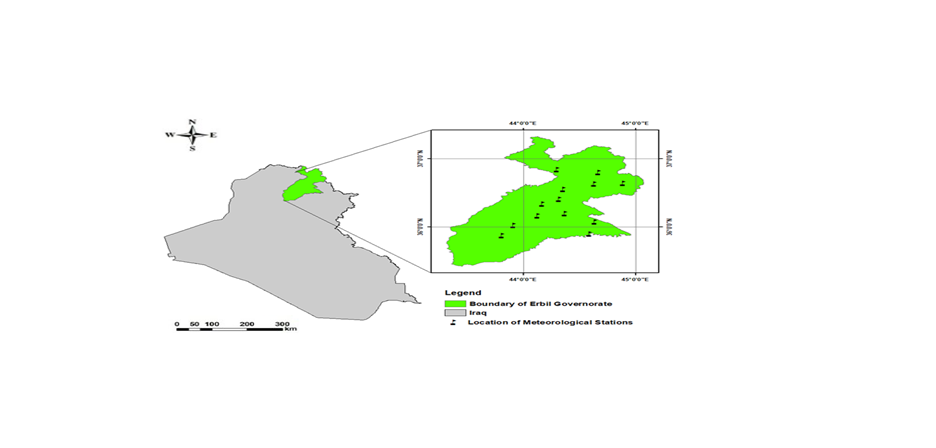
چاودێریکردنی فرەچەشنی زیندهگی زۆر گرنگە بۆ پاراستنی لهباری تهندروستی ئیکۆسیستەم، بەڵام لەگەڵ ئەوەشدا شێوازە تەقلیدییەکان ڕووبەڕووی ئاستەنگ دەبنەوە لەرووی دهستپێگهیشتن و دووریهكانی. لهم توێژینەوەیە داتای هەستکردن لە دوورەوە بهكارهاتووه بۆ چاودێریکردنی گۆڕانکارییەکانی فرەچەشنی زیندهگی لە پارێزگای هەولێر، عێراق، بە بهكارهێنانی پێوەرەکانی رووهكی چاككراو (EVI پێوەرە ستانداردەی بارانبارین (SPI)، و بەرهەمهێنانی سەرەتایی تۆڕ (NPP) وەک گۆڕاو بۆ گۆڕانی فرەچەشنی زیندهگی. توێژینەوەکە MODIS، وێنەی Sentinel-2، و داتای کەشناسی تێکەڵ دەکات بۆ هەڵسەنگاندنی گۆڕانکارییە شوێنی و کاتیەکانی NPP، EVI، و SPI. دهرئهنجامه سەرەکییەکان ئاماژەن دهكهن بۆ گۆڕانکاری ساڵانەی بەرچاو لەEVI . بەهای ناوەندی EVI لە ساڵی 2017 له 2 بهرز بۆتهوه بۆ نزیهی 3 لە ساڵی 2020، ئەمەش ئاماژەیە بۆ بەرزبوونەوەی چڕی ڕووەک و تەندروستی. بە هەمان شێوە، NPP بهرزبوونهوهی بەها ناوەندییەکان لە نزیکەی 0.15 كگم كاربۆن/م2 لە ساڵی 2017 بۆ نزیکەی 0.25 كگم كاربۆن/م2 لە ساڵی 2020 نیشان دا، کە ئهمهش ڕەنگدانەوەی باشتربوونی تواناکانی ههڵمژینی کاربۆنە. ئەم ئاڕاستانه جەخت لەسەر خۆڕاگری و توانای ناوچەکە دەکەنەوە بۆ گۆڕانی کەشوهەوا، ههروهك لە پەیوەندی نێوان بەهاکانی EVI، NPP و SPIدا دەردەکەوێت. سەرەڕای ئەوەش، توێژینەوەکە پەیوەندییەکی ئەرێنی بەهێزی ئاشکرا کرد کە لە نێوان 0.68 بۆ 0.74 بوو، لە نێوان EVI کە لە داتاکانی Sentinel-2 وهرگیراوه و NPP کە لە مانگی دەستکردی MODIS وەرگیراوە.
ئەم توێژینەوەیە تیشک دەخاتە سەر کاریگەری هەستکردن لە دوورەوە لە دهستنیشان كردنی داینامیکی ئیکۆلۆژی ورد، کە تێڕوانینێکی چارەنووسساز بۆ پاراستنی فرەچەشنی زیندهگی و بەڕێوەبردنی ئیکۆسیستەمی بەردەوام لە پارێزگای هەولێر دابین دەکات.
سەرچاوەکان
-Abdullah, H., Omar, D. k., Polat, N., Bilgili, A. V., & Sharef, S. H. (2020). A comparison between day and night land surface temperatures using acquired satellite thermal infrared data in a winter wheat field. Remote Sensing Applications: Society and Environment, 19, 100368. doi:https://doi.org/10.1016/j.rsase.2020.100368
-Al-Hedny, S. M., Muhaimeed, A. S. J. E. R. S., & Iraq, G. i. (2020). Drought monitoring for Northern Part of Iraq using temporal NDVI and rainfall indices. 301-331.
-Daham, A., Han, D., Rico-Ramirez, M., & Marsh, A. J. E. e. s. (2018). Analysis of NVDI variability in response to precipitation and air temperature in different regions of Iraq, using MODIS vegetation indices. 77, 1-24.
-Elmqvist, T., Maltby, E., Barker, T., Mortimer, M., Perrings, C., Aronson, J., . . . Norberg, J. (2012). Biodiversity, ecosystems and ecosystem services. In The Economics of Ecosystems and Biodiversity: Ecological and economic foundations (pp. 41-111): Routledge.
-Gaznayee, H. A. A., Al-Quraishi, A. M. F., & Al-Sulttani, A. H. A. J. I. J. o. S. (2021). Drought spatiotemporal characteristics based on a vegetation condition index in Erbil, Kurdistan Region, Iraq. 4545-4556.
-Hickler, T., Smith, B., Sykes, M. T., Davis, M. B., Sugita, S., & Walker, K. J. E. (2004). Using a generalized vegetation model to simulate vegetation dynamics in northeastern USA. 85(2), 519-530.
-Huete, A., Didan, K., Miura, T., Rodriguez, E. P., Gao, X., & Ferreira, L. G. J. R. s. o. e. (2002). Overview of the radiometric and biophysical performance of the MODIS vegetation indices. 83(1-2), 195-213.
-Hussein, S. O., Kovács, F., Tobak, Z., Abdullah, H. J. J. A. G. D. L., & series, E. (2018). Spatial distribution of vegetation cover in Erbil city districts using high-resolution Pléiades satellite image. 12(1), 10-22.
-Kooistra, L., Wamelink, W., Schaepman-Strub, G., Schaepman, M., van Dobben, H., Aduaka, U., & Batelaan, O. J. R. S. o. E. (2008). Assessing and predicting biodiversity in a floodplain ecosystem: Assimilation of net primary production derived from imaging spectrometer data into a dynamic vegetation model. 112(5), 2118-2130.
-Kuenzer, C., Ottinger, M., Wegmann, M., Guo, H., Wang, C., Zhang, J., . . . Wikelski, M. J. I. J. o. R. S. (2014). Earth observation satellite sensors for biodiversity monitoring: potentials and bottlenecks. 35(18), 6599-6647.
-Lei, T., Feng, J., Lv, J., Wang, J., Song, H., Song, W., & Gao, X. J. J. o. e. m. (2020). Net Primary Productivity Loss under different drought levels in different grassland ecosystems. 274, 111144.
-Maclaurin, J., & Sterelny, K. (2008). What is biodiversity? : University of Chicago Press.
-Mustafa Alee, M., Danandeh Mehr, A., Akdegirmen, O., & Nourani, V. J. S. (2023). Drought assessment across erbil using satellite products. 15(8), 6687.
-Nagendra, H., Lucas, R., Honrado, J. P., Jongman, R. H., Tarantino, C., Adamo, M., & Mairota, P. J. E. I. (2013). Remote sensing for conservation monitoring: Assessing protected areas, habitat extent, habitat condition, species diversity, and threats. 33, 45-59.
-Rawat, U., & Agarwal, N. K. J. E. C. J. (2015). Biodiversity: Concept, threats and conservation. 16(3), 19-28.
-Razvanchy, H. A., & Fayyadh, M. A. J. B. J. o. A. S. (2022). GIS and AHP Based Techniques for Agricultural Land Suitability Assessment in Erbil Province, Kurdistan region, Iraq. 35(1), 140-157.
-Roxburgh, S., Berry, S. L., Buckley, T., Barnes, B., & Roderick, M. J. F. E. (2005). What is NPP? Inconsistent accounting of respiratory fluxes in the definition of net primary production. 19(3), 378-382.
-Sharma, I., & Birman, S. (2024). Biodiversity Loss, Ecosystem Services, and Their Role in Promoting Sustainable Health. In The Climate-Health-Sustainability Nexus: Understanding the Interconnected Impact on Populations and the Environment (pp. 163-188): Springer.
-Taelman, S. E., Schaubroeck, T., De Meester, S., Boone, L., & Dewulf, J. J. S. o. t. T. E. (2016). Accounting for land use in life cycle assessment: the value of NPP as a proxy indicator to assess land use impacts on ecosystems. 550, 143-156.
-Terwayet Bayouli, O., Zhang, W., & Terwayet Bayouli, H. J. A. J. o. G. (2023). Assessment of drought characteristics and its impacts on net primary productivity (NPP) in southeastern Tunisia. 16(1), 26.
-Turner, W., Spector, S., Gardiner, N., Fladeland, M., Sterling, E., Steininger, M. J. T. i. e., & evolution. (2003). Remote sensing for biodiversity science and conservation. 18(6), 306-314.
-Vihervaara, P., Auvinen, A.-P., Mononen, L., Törmä, M., Ahlroth, P., Anttila, S., . . . Conservation. (2017). How essential biodiversity variables and remote sensing can help national biodiversity monitoring. 10, 43-59.
-Wang, R., & Gamon, J. A. J. R. S. o. E. (2019). Remote sensing of terrestrial plant biodiversity. 231, 111218.
-Yu, X., Wu, Z., & Guo, X. (2013). Investigating the potential of GIMMS and MODIS NDVI data sets for estimating gross primary productivity in Harvard Forest. Paper presented at the MultiTemp 2013: 7th International Workshop on the Analysis of Multi-temporal Remote Sensing Images.
-Zeng, X., Hu, Z., Chen, A., Yuan, W., Hou, G., Han, D., . . . Luo, D. J. G. C. B. (2022). The global decline in the sensitivity of vegetation productivity to precipitation from 2001 to 2018. 28(22), 6823-6833.
-Zhang, C. I., Lee, J. B., Kim, S., & Oh, J.-H. J. P. i. O. (2000). Climatic regime shifts and their impacts on marine ecosystem and fisheries resources in Korean waters. 47(2-4), 171-190.
-Salgotra, Romesh Kumar, and Bhagirath Singh Chauhan. "Genetic diversity, conservation, and utilization of plant genetic resources." Genes 14.1 (2023): 174.
-Garroutte, Erica L., Andrew J. Hansen, and Rick L. Lawrence. "Using NDVI and EVI to map spatiotemporal variation in the biomass and quality of forage for migratory elk in the Greater Yellowstone Ecosystem." Remote Sensing 8.5 (2016): 404.
##submission.downloads##
بڵاو کرایەوە
چۆنییەتی بەکارهێنانی سەرچاوە
ژمارە
بەش
##submission.license##
##submission.copyrightStatement##
##submission.license.cc.by4.footer##

