
مراقبة التنوع الحيوي في محافظة أربيل – العراق باستخدام بيانات الاستشعار عن بعد
DOI:
https://doi.org/10.21271/zjhs.29.1.14الكلمات المفتاحية:
Biodiversity monitoring, Remote sensing, Sentinel-2, MODIS, Standardized Precipitation Index (SPI), Net Primary Productivity (NPP), Enhanced Vegetation Index (EVI).الملخص
مراقبة التنوع الحيوي في محافظة أربيل – العراق باستخدام بيانات الاستشعار عن بعد
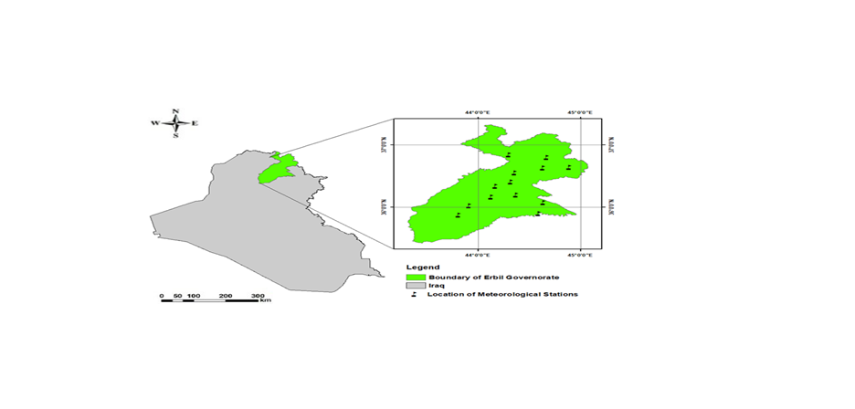
يعد مراقبة التنوع الحيوي أمرا ضروريا للحفاظ على صحة النظام البيئي، إلا أن الأساليب التقليدية تواجه تحديات في إمكانية الوصول و مستوياته. تستخدم هذه الدراسة بيانات الاستشعار عن بعد لمراقبة التغيرات في التنوع الحيوي في محافظة أربيل، العراق، مع التركيز على مؤشر معزز للغطاء النباتي (EVI)، و مؤشر الموحد للامطار (SPI)، وصافي الإنتاجية الأولية (NPP) كعوامل بديلة لتغير التنوع الحيوي. يدمج البحث صور MODIS وصور Sentinel-2 وبيانات الأرصاد الجوية لتقييم الاختلافات المكانية والزمانية في NPP وEVI وSPI. وتشير النتائج الرئيسية إلى حدوث تغيرات سنوية كبيرة في صحة الغطاء النباتي وإنتاجيته. من عام 2017 إلى عام 2020، ارتفع متوسط قيمة مؤشر EVI من أقل من 2 في عام 2017 إلى ما يقرب من 3 في عام 2020، مما يشير إلى تعزيز كثافة الغطاء النباتي وصحته. وبالمثل، أظهرت NPP تقلبات مع زيادة القيم المتوسطة من حوالي 0.15 كجم كربون/م² في عام 2017 إلى ما يقرب من 0.25 كجم كربون/م² في عام 2020، مما يعكس تحسن قدرات امتصاص الكربون. وتؤكد هذه الاتجاهات قدرة المنطقة على الصمود واستجابتها للتقلبات المناخية، كما يتضح من العلاقة بين قيم مؤشر EVI و NPP و SPI. علاوة على ذلك، كشفت الدراسة عن وجود علاقة إيجابية قوية، تتراوح من 0.68 إلى 0.74، بين مؤشر EVI من بيانات Sentinel-2 وNPP التي تم الحصول عليها من القمر الصناعي MODIS.
تسلط هذه الدراسة الضوء على فعالية الاستشعار عن بعد في التقاط الديناميكيات البيئية التفصيلية، مما يوفر رؤى مهمة للحفاظ على التنوع الحيوي والإدارة المستدامة للنظام البيئي في محافظة أربيل.
المراجع
-Abdullah, H., Omar, D. k., Polat, N., Bilgili, A. V., & Sharef, S. H. (2020). A comparison between day and night land surface temperatures using acquired satellite thermal infrared data in a winter wheat field. Remote Sensing Applications: Society and Environment, 19, 100368. doi:https://doi.org/10.1016/j.rsase.2020.100368
-Al-Hedny, S. M., Muhaimeed, A. S. J. E. R. S., & Iraq, G. i. (2020). Drought monitoring for Northern Part of Iraq using temporal NDVI and rainfall indices. 301-331.
-Daham, A., Han, D., Rico-Ramirez, M., & Marsh, A. J. E. e. s. (2018). Analysis of NVDI variability in response to precipitation and air temperature in different regions of Iraq, using MODIS vegetation indices. 77, 1-24.
-Elmqvist, T., Maltby, E., Barker, T., Mortimer, M., Perrings, C., Aronson, J., . . . Norberg, J. (2012). Biodiversity, ecosystems and ecosystem services. In The Economics of Ecosystems and Biodiversity: Ecological and economic foundations (pp. 41-111): Routledge.
-Gaznayee, H. A. A., Al-Quraishi, A. M. F., & Al-Sulttani, A. H. A. J. I. J. o. S. (2021). Drought spatiotemporal characteristics based on a vegetation condition index in Erbil, Kurdistan Region, Iraq. 4545-4556.
-Hickler, T., Smith, B., Sykes, M. T., Davis, M. B., Sugita, S., & Walker, K. J. E. (2004). Using a generalized vegetation model to simulate vegetation dynamics in northeastern USA. 85(2), 519-530.
-Huete, A., Didan, K., Miura, T., Rodriguez, E. P., Gao, X., & Ferreira, L. G. J. R. s. o. e. (2002). Overview of the radiometric and biophysical performance of the MODIS vegetation indices. 83(1-2), 195-213.
-Hussein, S. O., Kovács, F., Tobak, Z., Abdullah, H. J. J. A. G. D. L., & series, E. (2018). Spatial distribution of vegetation cover in Erbil city districts using high-resolution Pléiades satellite image. 12(1), 10-22.
-Kooistra, L., Wamelink, W., Schaepman-Strub, G., Schaepman, M., van Dobben, H., Aduaka, U., & Batelaan, O. J. R. S. o. E. (2008). Assessing and predicting biodiversity in a floodplain ecosystem: Assimilation of net primary production derived from imaging spectrometer data into a dynamic vegetation model. 112(5), 2118-2130.
-Kuenzer, C., Ottinger, M., Wegmann, M., Guo, H., Wang, C., Zhang, J., . . . Wikelski, M. J. I. J. o. R. S. (2014). Earth observation satellite sensors for biodiversity monitoring: potentials and bottlenecks. 35(18), 6599-6647.
-Lei, T., Feng, J., Lv, J., Wang, J., Song, H., Song, W., & Gao, X. J. J. o. e. m. (2020). Net Primary Productivity Loss under different drought levels in different grassland ecosystems. 274, 111144.
-Maclaurin, J., & Sterelny, K. (2008). What is biodiversity? : University of Chicago Press.
-Mustafa Alee, M., Danandeh Mehr, A., Akdegirmen, O., & Nourani, V. J. S. (2023). Drought assessment across erbil using satellite products. 15(8), 6687.
-Nagendra, H., Lucas, R., Honrado, J. P., Jongman, R. H., Tarantino, C., Adamo, M., & Mairota, P. J. E. I. (2013). Remote sensing for conservation monitoring: Assessing protected areas, habitat extent, habitat condition, species diversity, and threats. 33, 45-59.
-Rawat, U., & Agarwal, N. K. J. E. C. J. (2015). Biodiversity: Concept, threats and conservation. 16(3), 19-28.
-Razvanchy, H. A., & Fayyadh, M. A. J. B. J. o. A. S. (2022). GIS and AHP Based Techniques for Agricultural Land Suitability Assessment in Erbil Province, Kurdistan region, Iraq. 35(1), 140-157.
-Roxburgh, S., Berry, S. L., Buckley, T., Barnes, B., & Roderick, M. J. F. E. (2005). What is NPP? Inconsistent accounting of respiratory fluxes in the definition of net primary production. 19(3), 378-382.
-Sharma, I., & Birman, S. (2024). Biodiversity Loss, Ecosystem Services, and Their Role in Promoting Sustainable Health. In The Climate-Health-Sustainability Nexus: Understanding the Interconnected Impact on Populations and the Environment (pp. 163-188): Springer.
-Taelman, S. E., Schaubroeck, T., De Meester, S., Boone, L., & Dewulf, J. J. S. o. t. T. E. (2016). Accounting for land use in life cycle assessment: the value of NPP as a proxy indicator to assess land use impacts on ecosystems. 550, 143-156.
-Terwayet Bayouli, O., Zhang, W., & Terwayet Bayouli, H. J. A. J. o. G. (2023). Assessment of drought characteristics and its impacts on net primary productivity (NPP) in southeastern Tunisia. 16(1), 26.
-Turner, W., Spector, S., Gardiner, N., Fladeland, M., Sterling, E., Steininger, M. J. T. i. e., & evolution. (2003). Remote sensing for biodiversity science and conservation. 18(6), 306-314.
-Vihervaara, P., Auvinen, A.-P., Mononen, L., Törmä, M., Ahlroth, P., Anttila, S., . . . Conservation. (2017). How essential biodiversity variables and remote sensing can help national biodiversity monitoring. 10, 43-59.
-Wang, R., & Gamon, J. A. J. R. S. o. E. (2019). Remote sensing of terrestrial plant biodiversity. 231, 111218.
-Yu, X., Wu, Z., & Guo, X. (2013). Investigating the potential of GIMMS and MODIS NDVI data sets for estimating gross primary productivity in Harvard Forest. Paper presented at the MultiTemp 2013: 7th International Workshop on the Analysis of Multi-temporal Remote Sensing Images.
-Zeng, X., Hu, Z., Chen, A., Yuan, W., Hou, G., Han, D., . . . Luo, D. J. G. C. B. (2022). The global decline in the sensitivity of vegetation productivity to precipitation from 2001 to 2018. 28(22), 6823-6833.
-Zhang, C. I., Lee, J. B., Kim, S., & Oh, J.-H. J. P. i. O. (2000). Climatic regime shifts and their impacts on marine ecosystem and fisheries resources in Korean waters. 47(2-4), 171-190.
-Salgotra, Romesh Kumar, and Bhagirath Singh Chauhan. "Genetic diversity, conservation, and utilization of plant genetic resources." Genes 14.1 (2023): 174.
-Garroutte, Erica L., Andrew J. Hansen, and Rick L. Lawrence. "Using NDVI and EVI to map spatiotemporal variation in the biomass and quality of forage for migratory elk in the Greater Yellowstone Ecosystem." Remote Sensing 8.5 (2016): 404.
التنزيلات
منشور
كيفية الاقتباس
إصدار
القسم
الرخصة
الحقوق الفكرية (c) 2025 Shwan Othman Hussein, Daban Kadhim Omar, Karzan Ahmed Abdulwahid

هذا العمل مرخص بموجب Creative Commons Attribution 4.0 International License.


