
Analysis and Evaluation of the Geographical Potential for Agricultural Development in the Choman District Using the AHP Model
DOI:
https://doi.org/10.21271/zjhs.29.4.6Keywords:
agriculture, agricultural development, environment, space.Abstract
Agricultural development is considered one of the most important developments, whether as a type of development or at the level of economic activity sectors. The importance of the agricultural sector and agricultural development has a great impact on the livelihood of the population and economic and national income. It is strongly linked to economic growth and trade. In this context, an attempt was made to conduct research on this important issue in an important geographical area, namely the choman region.
The research area has several important geographical capabilities that can be developed, provided that the shortcomings are addressed appropriately. The main objective of this research is to identify the nature of the geographical location and natural and human capabilities, as well as to evaluate the positive and negative points of each capability, with the presentation of appropriate solutions. It relies on inductive methods and the use of quantitative tools and the use of geographic information systems to identify problems and choose the best development sites.
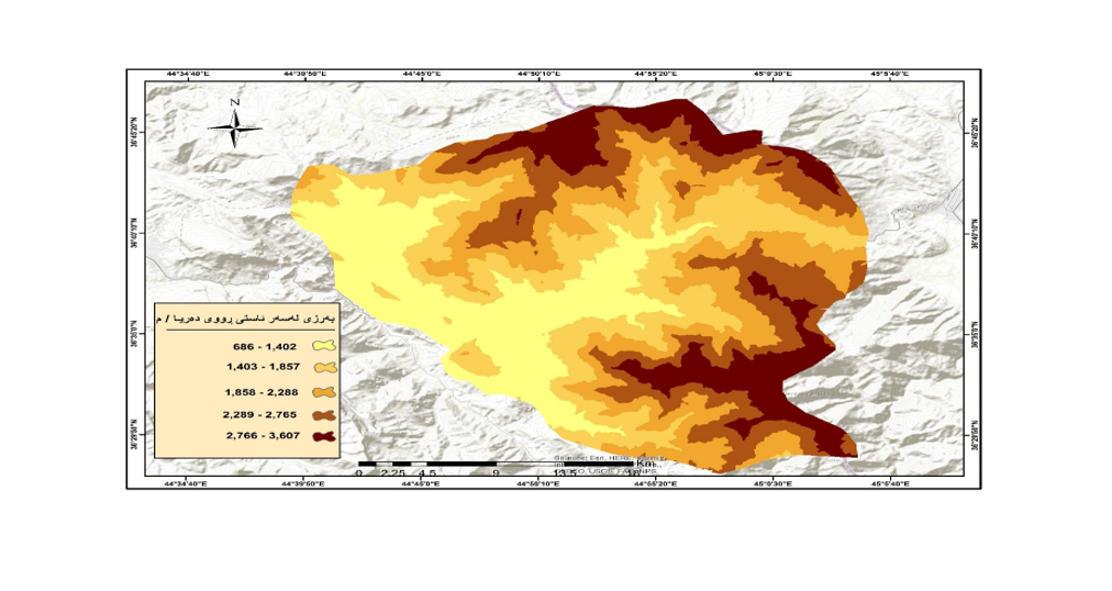
To achieve all of the above, the research content was divided into four main sections, and the first, second and third sections were devoted to defining the research field. The last topic consists of the criteria used for agricultural development indicators. The indicators were highlighted in two separate criteria and the best places for agriculture were identified through the AHP model. Finally, the research reached several conclusions and recommendations. The most important results are the decrease in the area of land cultivated with crops in the study area between (2012 - 2023) from (7132) acres to (7020) acres of cultivated land. This is not a good indicator for the development process. On the one hand, according to the choice of the best place for agriculture, the area of suitable land is 67.72% and the unsuitable land is 6.10%, which is a positive and important point for its agricultural development.
References
- أبوبكر، صدرالدین، حمد، جلال جمدأمین،( 2000)، دلیل المحاصیل الزارعیة فی أربیل، ط1.
- غانم، علی غانم أحمد، (2010), المناخ التطبیقي، دار المسيرة للنشر و التوزيع، و ط 1 ،عمان ، الأردن.
- _حداد هاشم یاسین حهمدهمین ، و ولی ، كامهران محمود ، (2011)، ئهتلهسی پارێزگای ههولێر، چاپی دووهم، چاپخانهی شههاب، ههولێر.
- أبو علي، منصور حمدی، ( 2004)، الجغرافيا الاقتصادية – الجغرافيا الزراعية، داروئل للنشر و التوزیع، عمان.
- الدليمي، آمنة جبار مطر درويش، مقومات التنمیة الزراعیة المستدامة في محافظة الانبار، رسالة ماجستیر، كلیة التربیه للعلوم الانسانیة، جامعة الانبار، الانبار.
- الدلیمی، صبحی أحمد، و عبدالرزاق عبدالسلام عارف،( 2020)، جغرافیة الزراعة، ط1، مطبعة دارأمجد للنشرو توزیع، عمان.
- الدلیمي، محمد دلف أحمد، فواز أحمد موسی، (2009)، جغرافیة التنمیة( مفاهیم، نظریات، تطبیق) ط 2، دار الفرقات للغات، دمشق، سوریا.
- الدليمي، محمد دلف أحمد، و موسی فواز أحمد، ( 2009)، الاتجاهات الحدیثیة في البحث الجغرافي باستخدام ديلفي فى البحوث الجغرافية التطبيقية، مجلة جامعة الانبار ( للعلوم لانسانية ، المجلد4 العدد3.
- سعید، نادیه طلعت،( 2016) الأمكانات الجغرافیة للتنمیة ( السیاحة _ الزراعة) فی حوض نهر رواندز، اطروحة دكتوراة، كلیة الأداب، جامعة صلاح الدین، أربیل.
- سعید، عودة، (2022)، دور نظم المعلومات الجغرافية في دراسة التنمية المستدامة للأراضي الزراعية -بلدية سيدي داود ولاية بومرداس نموذجا، مجلة العلوم وافاق المعارف، المجلدالثانی، العدد الثانی، الجزائیر.
- الشبانی، مناهل طالب حریجة (2010)، لتحلیل المكانی لإنتاج المحاصیل الحقلیة فی محافظة القادسیة للفترة من 1999- 2008، رسالة ماجستیر، كلیة الاداب، القادسیة.
- المثولثي، الهادی، و أخرون،( 2004)، قاموس الجغرافیا، الدار العربیة للعلوم، بیروت، لبنان.
- وهبی، صالح محمود، (2000)، اصول الجغرافیة الزراعیة ، الطبیعة الاولی، دیمشق، سوریا.
- حكومهتی ههرێمی كوردستان، وهزرارهتی كشتوكاڵ و سهرچاوهكانی ئاو، بهرێوهبهرایهتی گشتی سهرچاوهكانی ئاو، بهرێوبهڕایهتی سهرچاوهی ئاوی سهر زهوی،(2023)، بهشی سیستهمی زانیاری جوگرافیا، هۆبهی پلاندانان.
- _ چاوپێكهوتنی كهسی لهگهڵ بهرێز نیهاد ئۆمهراوهیی، لهرێكهوتی8/9/2024. جووتیار له قهزای چۆمان.
- نموونهی بهرزی و نزمی ژمارهیی بهكارهێنانی (30m_DEM) پارێزگای ههولێرnternational _elevation_ models www.usgsquads.com /prod_ digita
- حكومهتی ههرێمی كوردستان، وهزرارهتی كشتوكاڵ و ئاودێری، بهرێوهبهرایهتی كشتوكاڵی چۆمان،( 2024)، داتای پهین كردن و مادهی قڕكهره زیانبهخشهكان، بڵاونهكراوه.
- حكومهتی ههرێمی كوردستان، وهزرارهتی كشتوكاڵ و ئاودێری، بهرێوهبهرایهتی كشتوكاڵی چۆمان،( 2024)، وێستگهی كهشناسی، تۆماری مانگانهو ساڵانهی پلهی گهرمی و دابارین (2010_ 2023).
- حكومهتی ههرێمی كوردستان، وهزارهتی پلاندانان، دهستهی ئاماری ههرێم، (2024) نهخشهی كارگێری ههرێمی كوردستان.
-
- حكومهتی ههرێمی كوردستان، وهزارهتی پلاندانان. بهرێوهبهرایهتی ئاماری پارێزگای ههولێر،(2024) بهشی GIS، وێنهی ئاسمانی (Quick bird 10M) قهزای چۆمان بڵاونهكراوه.
- حكومهتی ههرێمی كوردستان، وهزارهتی ئاوهدانكردنهو و نیشتهجێكردن، بهرێوهبهرایهتی گشتی ڕێگاوبان و ئاوهدانكردنهوه و نیشتهجێكردنی ههولێر، بهرێوهبهرایهتی چاككردنهوهو پاراستنی ڕێگاوبانی ههولێر، (2023)، بهشی پلاندانان و زانیاری ، داتا ڕێگاكانی پارێزگای ههولێر.
-Abedini, M; Ghasemyan, B; Rezaei Mogaddam, M H. ,(2017), Landslide susceptibility mapping in Bijar city, Kurdistan Province, Iran: a comparative study by logistic regression and AHP models. Environmental Earth Sciences; Heidelberg.
-Palcic , Lztok , (2009), Analytical Hierarchy Process as a tool for selecting and evaluating projects, International Journal of Simulation Modelling, p 16-26.
R.W. Saaty, (1980), The analytic hierarchy process—what it is and how it is used , Hill ,New work.
Downloads
Published
How to Cite
Issue
Section
License
Copyright (c) 2025 Hevi Abdullah Azo, Nadia Talat Saeed

This work is licensed under a Creative Commons Attribution 4.0 International License.


