
Urban Flood Simulation in Erbil City by Using Storm Water Management Model (SWMM)
DOI:
https://doi.org/10.21271/ZJPAS.35.5.1Keywords:
Urban flooding; SWMM; Dynamic wave method; Horton equationAbstract
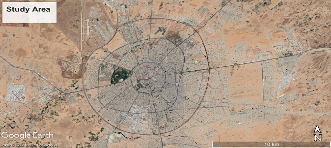
One of the worst and most frequent natural disasters is flooding. Due to changes in precipitation patterns brought on by global climate change, flash floods are a threat to most cities. When it rains heavily, infrastructure capacity could be insufficient, and flash floods occur at weak points. This study evaluates the drainage system network capacity of the worst flood risk area using the Storm Water Management Model (SWMM). The study area is around the Council of Ministers, which is divided into 23 sub-catchments, and maximum daily rainfall data was collected from the Erbil Directorate of Meteorology and Seismology. This study analyzed three maximum daily rainfall events in three different decades of rainfall data from 1992–2022 to estimate the likelihood of flooding. The three events associated with maximum daily precipitation were 103.9 mm, 79.0 mm, and 71.8 mm on February 3, 2006, November 21, 1992, and January 28, 2013, respectively, using the Indian Meteorological Department (IMD) method to convert daily rainfall data to hourly rainfall. The dynamic wave routing method is used for flow routing, and the Horton equation is used to measure infiltration. The flood rate amount in the nodes is classified into three stages: moderate flood (0.001 - 0.1 m3/s), high flood (0.1 - 0.5 m3/s), and very high flood (more than 0.5 m3/s). The results showed that the number of flood nodes is (14, 10, and 10) for each of the three events, with (4, 3, and 3) nodes experiencing moderate floods, (5, 6, and 6) nodes experiencing high flood rates, and (5, 1, and 1) nodes experiencing very high flood rates. It is indicated that the drainage system networks in the study area are unable to handle the amount of runoff and are poorly constructed.
References
ABDELKARIM, A., GABER, A. F., YOUSSEF, A. M. & PRADHAN, B. 2019. Flood hazard assessment of the urban area of Tabuk City, Kingdom of Saudi Arabia by integrating spatial-based hydrologic and hydrodynamic modeling. Sensors, 19, 1024.
BARREDO, J. I. 2009. Normalised flood losses in Europe: 1970–2006. Natural hazards and earth system sciences, 9, 97-104.
BOUAIDA, J., WITAM, O., IBNOUSSINA, M., DELMAKI, A. E. F. & BENKIRANE, M. 2021. Contribution of remote sensing and GIS to analysis of the risk of flooding in the Zat basin (High Atlas-Morocco). Natural Hazards, 108, 1835-1851.
CABRERA, J. S. & LEE, H. S. 2020. Flood risk assessment for Davao Oriental in the Philippines using geographic information system‐based multi‐criteria analysis and the maximum entropy model. Journal of Flood Risk Management, 13, e12607.
CHEN, Y., ZHOU, H., ZHANG, H., DU, G. & ZHOU, J. 2015. Urban flood risk warning under rapid urbanization. Environmental research, 139, 3-10.
COURTY, L. G., RICO-RAMIREZ, M. Á. & PEDROZO-ACUÑA, A. 2018. The significance of the spatial variability of rainfall on the numerical simulation of urban floods. Water, 10, 207.
DESALEGN, H. & MULU, A. 2021. Mapping flood inundation areas using GIS and HEC-RAS model at Fetam River, Upper Abbay Basin, Ethiopia. Scientific African, 12, e00834.
FALCONER, R. H., COBBY, D., SMYTH, P., ASTLE, G., DENT, J. & GOLDING, B. 2009. Pluvial flooding: new approaches in flood warning, mapping and risk management. Journal of Flood Risk Management, 2, 198-208.
GHARIB, K. N., MUSTAFA, N. F. & RASHID, H. M. 2021. Urban Rainwater Harvesting Assessment in Sulaimani Heights District, Sulaimani City, KRG, Iraq. UHD Journal of Science and Technology, 5, 48-55.
GUAN, M., SILLANPÄÄ, N. & KOIVUSALO, H. 2015. Modelling and assessment of hydrological changes in a developing urban catchment. Hydrological Processes, 29, 2880-2894.
HAMA, R. H., HAMAD, R. T. & AZIZ, F. H. 2014. Climate change in relation to rainfall and temperature in Erbil province, Kurdistan, Iraq. Tunisian Association of Digital Geographic Information, 8Th International Congers Geo Tunis, Tunis, 8.
HAMEED, H. M. 2017. Estimating the effect of urban growth on annual runoff volume using GIS in the Erbil sub-basin of the Kurdistan Region of Iraq. Hydrology, 4, 12.
HASSAN, I. 1998. Urban hydrology of Erbil city Region. Degree of doctor of philosophy in geology (hydrogeology). University of Baghdad.
HERMAS, E., GABER, A. & EL BASTAWESY, M. 2021. Application of remote sensing and GIS for assessing and proposing mitigation measures in flood-affected urban areas, Egypt. The Egyptian Journal of Remote Sensing and Space Science, 24, 119-130.
MOHAMED, S. A. 2019. Application of satellite image processing and GIS-Spatial modeling for mapping urban areas prone to flash floods in Qena governorate, Egypt. Journal of African Earth Sciences, 158, 103507.
MUSTAFA, A. M., MUHAMMED, H. & SZYDŁOWSKI, M. 2019. Extreme rainfalls as a cause of urban flash floods; a case study of the Erbil-Kurdistan region of Iraq. Acta Scientiarum Polonorum Formatio Circumiectus, 18, 113-132.
NOTARO, V., FONTANAZZA, C. M., FRENI, G. & PULEO, V. 2013. Impact of rainfall data resolution in time and space on the urban flooding evaluation. Water science and technology, 68, 1984-1993.
OUBENNACEUR, K., CHOKMANI, K., NASTEV, M., LHISSOU, R. & EL ALEM, A. 2019. Flood risk mapping for direct damage to residential buildings in Quebec, Canada. International journal of disaster risk reduction, 33, 44-54.
PORTUGUÉS-MOLLÁ, I., BONACHE-FELICI, X., MATEU-BELLÉS, J. & MARCO-SEGURA, J. 2016. A GIS-Based Model for the analysis of an urban flash flood and its hydro-geomorphic response. The Valencia event of 1957. Journal of Hydrology, 541, 582-596.
RAHMANI, V., HUTCHINSON, S. L., HARRINGTON JR, J. A. & HUTCHINSON, J. S. 2016. Analysis of frequency and magnitude of extreme rainfall events with potential impacts on flooding: A case study from the central United States. International Journal of Climatology, 36, 3578-3587.
ROSSMAN, L. A. 2010. Storm water management model user's manual, version 5.0, National Risk Management Research Laboratory, Office of Research and ….
SAMELA, C., ALBANO, R., SOLE, A. & MANFREDA, S. 2018. A GIS tool for cost-effective delineation of flood-prone areas. Computers, Environment and Urban Systems, 70, 43-52.
SILLANPÄÄ, N. & KOIVUSALO, H. 2015. Impacts of urban development on runoff event characteristics and unit hydrographs across warm and cold seasons in high latitudes. Journal of Hydrology, 521, 328-340.
TENG, J., JAKEMAN, A. J., VAZE, J., CROKE, B. F., DUTTA, D. & KIM, S. 2017. Flood inundation modelling: A review of methods, recent advances and uncertainty analysis. Environmental modelling & software, 90, 201-216.
Downloads
Published
How to Cite
Issue
Section
License
Copyright (c) 2023 Bakhtiyar A. Ali, Dana K. Mawlood

This work is licensed under a Creative Commons Attribution 4.0 International License.